Space planning, access and movement
From swept path to something everyone can understand.
Many projects come down to the same practical questions. A swept-path drawing can answer them for an engineer. An interactive model answers them for everyone else in the room.
- Will it fit?
- Will it turn?
- Can it unload?
- Can it get back out?
Try it
Prove the route on paper. Understand it in 3D.
This is a real project model. Choose a gate width, run the articulated lorry in and out, and read the result. The swept path is drawn as it moves, and any clash is named.
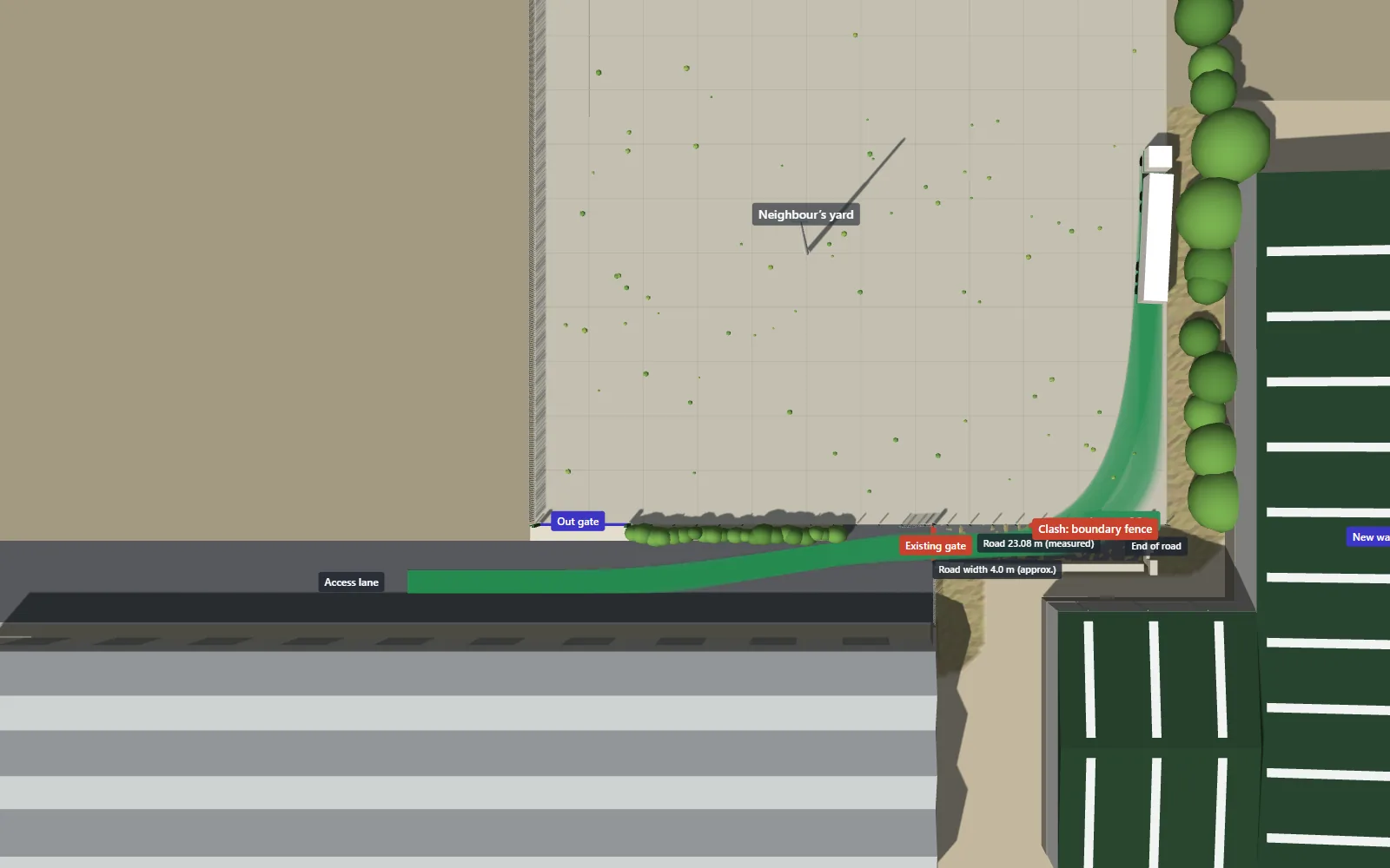
How to move: Drag to orbit, right-drag to pan, scroll or pinch to zoom.
Model note: Illustrative. Road length measured, road width 4.0 m approx., other positions scaled from aerial imagery. Artic 16.5 m, swept path indicative, best line taken each time.
Inputs and outputs
Not vehicle animation. Decision support for constrained space.
What we can work from
- Swept-path analysis from AutoTrack or similar
- Transport consultant drawings and reports
- Vehicle specifications and dimensions
- Measured site dimensions and surveys
- CAD and site layouts
- Gate and access geometry
- Aerial imagery
- Operational requirements and constraints
What you get
- Interactive vehicle movement models
- Entry and exit demonstrations
- Turning and reversing visualisation
- Loading and unloading scenarios
- Alternative gate or access comparisons
- Clash indication
- Plan, aerial and driver-eye views
- Access and movement drawings
Where it applies
Almost anywhere access, delivery or operating space is tight.
Logistics and industrial
- Warehouse and distribution yards
- Loading bays and docks
- Waste and recycling facilities
- Factories and manufacturing plants
- Industrial estates and data centres
Construction
- Site logistics and delivery staging
- Crane and HIAB positions
- Abnormal loads and plant deliveries
- Tight urban sites
- Temporary access arrangements
Estates and public sector
- Hospital and healthcare service yards
- Schools and universities
- Retail and supermarket service areas
- Fire appliance access, from supplied design information
- Underground or restricted delivery zones
Plant and equipment
- Major equipment replacement routes
- Plant installation and removal
- Maintenance access
- Utilities and energy compounds
- Infrastructure sites
Visualising analysis, not replacing it
Where a transport consultant has produced swept-path analysis, we translate that analysis into an interactive environment without changing what it says. Where we build an illustrative scenario ourselves from agreed information, we label it clearly as illustrative.
Start a project
Got a tight site or a difficult delivery?
Send us the site plan, the vehicle and the problem. A tracking drawing helps, but it isn't essential to start the conversation.